Roaming The San Juan Basin-Part 2
My previous post: Roaming The San Juan Basin-Part 1, was about the first day of a two-day road trip through the expanse of a great bowl shaped depression in the middle of the Colorado Plateau in northwest New Mexico. I spent Saturday night in Farmington and awoke early on Sunday. I had planned to head straight home from there, but as I prepared to leave, I thought better of it and decided to do some more exploring. As I drove up the road that leads from Farmington to the edge of the basin, I began to formulate a plan. I decided that I would avoid any of my normal haunts: the Bisti Wilderness, Ah Shi Sle Pah, etc. and that I would try to stay on dirt or gravel roads as much as possible. With this blog post in mind, I also decided to take a photojournalistic approach to making my images as opposed to my usual process.
I left the paved road about forty miles south of Farmington and immersed myself in the rolling, broken landscape. The San Juan Basin has numerous drainages of all sizes that carve the washes and valleys that form the irregular surface and expose the long buried geological features. I turned south on a road I knew would take me past Ah Shi Sle Pah…forbidden territory on this trip. I noticed three abandoned dwellings off to the west. The walls were of rock; the roofs, non-existent or barely there. They had a melancholy look to them; it was as though they were being swallowed by the great expanse that surrounded them.
A few miles further along the road, I saw a band of horses; one group of seven animals, and a mare and foal off by themselves. I stopped the car and walked to the side of the road to set up my tripod and the larger cluster immediately moved farther away from me. I made a few exposures and decided I would try to get closer, but the horses ran to the edge of the wash while the closest one–a stallion and probably the alpha–stood his ground and began to snort and pound the ground with his hoof. From this behavior, I surmised that this was a wild band; the tame horses I have encountered are typically friendly and will even approach to within an arm’s length.
I took the hint and returned to the car. I didn’t want to alarm the animals any more than I already had. I didn’t make it more than a half mile further when I spotted a smaller group of three white horses on the south side of the road. These were more friendly, but still more stand-offish than usual. They continued their grazing, but were wary of my presence.
Now I dropped down into Kimbeto Wash, a key drainage for this part of the San Juan Basin. I came to a tee in the road; to the left, Ah Shi Sle Pah, to the right, unknown territory. I turned right and crossed Kimbeto Wash. Less than a quarter mile further along was a road to the left and a sign: Chaco Canyon miles. The mileage was illegible. Onward.
I was excited to find a back way into Chaco; connecting the dots on a map has always been satisfying for me. The road crossed a grassy plain with a low mesa on the southern horizon. The only other visible feature was a lone hogan about a hundred yards off the road to the west. After about ten miles there was a sharp left turn and the track dipped down and crossed Chaco Wash before continuing up to the top of a high plateau.
By now, I was firmly into a spontaneous wandering frame of mind; I took a turn onto a two-track that seemed to lead to the plateau’s edge, but the road curved back and dead-ended at an abandoned homestead, complete with old cars and trash burn barrels. I’ve seen hundreds of these forlorn dwellings scattered across the remote desert areas I frequent. They always put me in a pensive mood.
Back on the main road, I soon came to an intersection that put me on the main road into Chaco Canyon. I decided to make a quick tour of the loop.
One of the most interesting elements of the ancient pueblo culture for me is the kiva. There are different kinds of kivas: many were used as places for social gathering, but most of them were ceremonial in nature. These adjacent kivas at Chetro Ketl–the second largest pueblo complex in Chaco Canyon–were used for religious ceremonies. Standing near these centuries-old subterranean enclosures made me feel connected to the ones who contrived and built these amazing communities.
Chaco Canyon is actually comprised of many pueblo complexes which were built over a span of four centuries and housed thousands of permanent residents and visitors from outlying sites. Of these complexes, Pueblo Bonito is the largest with more than eight hundred rooms. Like most of the pueblos in Chaco Canyon, Pueblo Bonito is built close against the wall of the mesa.
A little further along the loop road from Pueblo Bonito is Pueblo del Arroyo. It is situated along the edge of Chaco Wash and had three hundred rooms; it is thought to have been built by residents of Pueblo Bonito who moved due to overcrowding in the larger site.
I had already spent more time at Chaco Canyon than I wanted to, so I made for the exit that brought me to Hwy 57 heading south. As I passed the boundary I stopped to make a photograph of Fajada Butte which rises 440 feet above the canyon floor and is home to the most famous of all the Chaco sites: The Sun Dagger site. Three slabs of rock are set up and arranged in such a way that shafts of sunlight shine through them and onto specific parts of a petroglyph carved on the rock wall of the butte on each of the solstices and eqinoxes. More proof that these early Americans were far more advanced than the “savages” they have been depicted to be.
So, with these thoughts bouncing around in my head, I left Chaco behind and continued my exploration of the San Juan Basin. New Mexico State Road 57 is not what you might expect from the designation. Soon after it starts at US 550 between Huerfano and Nageezi, it sheds its asphalt coat and becomes a dirt road in the truest sense of the word. A good rain will quickly turn it into a quagmire of greasy clay, the kind that will defeat even the most serious four-wheel drive vehicle.
So, although I truly enjoy a good thunderstorm, I couldn’t help but hope that the building thunderheads would hold their water at least until I made it to the pavement of Indian Rte. 9 twenty-five miles to the south. I was about half way between Chaco and the paved road when over a rise in the road came two beautiful horses. One of them, a mare, turned sideways in the road and seemed to be bowing to me. I was enchanted; I spent over half an hour with them and when I finally left them behind, it was with some reluctance.
The remainder of the drive on NM 57 was relatively uneventful. There were a few small clusters of hoodoos and several small herds of livestock and then, suddenly I was at the intersection with the paved road. I looked back the way I had come, again with some reluctance, and then turned onto Indian Rte. 9. Almost immediately I came across three horses drinking from a water barrel. The scene seemed to say a good deal about the nature of this remote area, so I made a photograph of it.
After its intersection with NM 57, Indian Rte. 9 climbs onto a low mesa and emerges at Pueblo Pintado, an outlier of the pueblos at Chaco Canyon. This area is still inhabited by the descendants of the anasazi people, but now they live in houses scattered across the mesa in the shadow of the ruin that was their ancestral home. Another thirty miles brought me to Torreon. It is here that IR 9 becomes New Mexico 197 and turns northeast towards Cuba, NM. I turned onto an un-numbered, but paved road that runs from Torreon to the small village of San Luis in the Rio Puerco Valley. I passed a rock ruin that I had photographed before, but I stopped to make several exposures before continuing on towards San Luis.
As I drew near San Luis and the Rio Puerco Valley, a heavy thunderstorm passed ahead of me, nearly obscuring the volcanic monolith of Cabezon Peak. It seemed a fitting end to my adventure. Even as I neared home my mind began wandering and wondering about another dirt road I had noticed meandering into the vastness of the San Juan Basin…
The Intentional Image
I am a photographer, I consider myself an artist. I don’t want to take pretty pictures. I strive to make moving images. A deep green reservoir and a late winter storm moving across distant mesas,
or a lone tree trapped in its winter slumber while light dances on a faraway butte, I had an emotional response to these encounters. As a photographer and an artist, I want to capture not just the way these things appear, but the way these things feel. For me, the making of an image does not stop after the shutter is released. I am not one of those photographers that proudly proclaim that they only strive to capture the image the way it was; total objectivity and nothing less.
Art is not objective. By its very nature, it must be more than that. The artist attempts to convey a certain feeling to those who view his work. This can only be achieved by making an image that is more than just a representation of a scene. To do this requires what some condescendingly call “manipulation”. I call it creating the image and I will make no apologies for that.
Imagine a watering hole miles from any village or human activity. Now imagine a bovine visitor that plods through the dry, cracked, yet still soft earth that lines the edges of the oasis. The sky is overcast and the light, while soft, still shapes the edges of the cracks and lends a beautiful glow to the surface of the moving water.
In order to make these things tangible within the constraints of a two dimensional photographic image, some work must be done beyond the framing, composition, and exposure that make up the original capture. There must be some intention to the final outcome
There are many circumstances where I am challenged to make an image that is different from those that came before. From an oft viewed roadside scene to a sudden ethereal display of atmospheric magnitude, the real challenge is not just to capture a technically acceptable representation of that scene or phenomena, or to use some cliche template to compose it, the challenge is to render it in a way that is unique to my vision.
By doing so, I hope to evoke some response to my work, to kindle in the viewer an appreciation of the world beyond the pavement where they may never have been, or where they may have been, but have never really seen.
In one of his contributions to Eliot Porter’s book “The Place No One Knew: Glen Canyon On The Colorado”, Frank Waters wrote: “We measure minutes, the river ignores millennia.” And, although he was referring to the Colorado River, we can still make the same statement about any river. They carve and shape the lands they flow through not judging or playing favorites, and at times they provide a striking contrast to the arid environment that borders their banks.
The Rio Chama is such a river. It makes its way through north-central New Mexico flowing past some remote, but memorable scenery along the journey to its confluence with the Rio Grande. If you throw in just the right amount of foreboding skies and ethereal light, the scene becomes magical. It is my job to capture that magic and to cause those who view my image to be drawn in by it, to wonder what may lie beyond that bend. I hope I have succeeded.
Just Up (Or Down) The Road
I live in a wondrous place. The problem I have is that, being surrounded by beauty has made me a little thick-skinned; I guess you could say that I take it all for granted. So, I am putting my thoughts down in words accompanied by images, not so much to convince anyone else, but to remind myself.
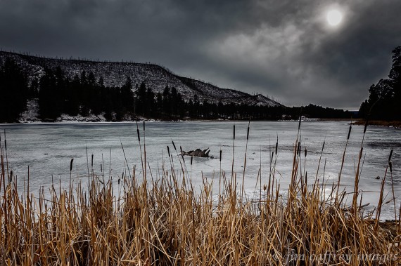
Fenton Lake is a small (less than 40 acres) manmade lake which was formed by construction of an earthen dam on the Rio Cebolla. The Cebolla itself is not really a river by most standards; it is, at most, three feet wide along most of its length. But, here in New Mexico, it qualifies. I made this image on a dark day. I was standing amongst the cattails at the north end of the lake. The ridge line to the southeast burned during the Lake Fire in 2002.
One of the most recognizable and well known features in the Jemez Valley is Battleship Rock. It is composed of rhyolite and was formed when the volcano that shaped the present-day Jemez Mountains erupted for the final (hopefully) time, the ash and lava flowed into a box canyon; when it cooled the rock filled the canyon and as the softer earth eroded away, the monolith was left exposed.
Jemez Springs is a small village (population: 250) that lies in the heart of San Antonio Canyon–the canyon formed by the Jemez River. Not much has changed, visually anyway, since I first came here in 1977. This is a typical mid-week, January evening.
New Mexico Highway 4 runs through San Antonio Canyon for about thirty miles before climbing onto the flanks of the Valle Grande and continuing across the mountain to Los Alamos (yes that Los Alamos: home of the atomic bomb). This stretch of the highway is about five miles south of Jemez Springs.
In the early years of the last century, there was an extensive logging operation in the Jemez Mountains. The logging company used a train to haul the logs to a mill in Gilman. They bored two tunnels through the solid granite that transects the Guadalupe Box and when the logging declined, the tracks were replaced by a road–New Mexico SR 485–which provides access to the Santa Fe National Forest. Some may recognize the tunnels from the role they played in the film “3:10 To Yuma”
The Jemez River cuts through Soda Dam, a large, seven thousand year old calcium carbonate formation left behind by a small, unassuming hot-spring next to Highway 4. It is located about three hundred yards from my door and is a huge tourist attraction as well as being the swimming hole for local youngsters.
The second image provides a better view of the river flowing through the “dam”, and of the swimming hole; the kids jump from the sides into the plunge pool. When the New Mexico Highway Department blasted through the formation to improve Highway 4, the building process was interrupted, and the dam has been eroding since then.
My Few Of My Favorite Things
Wow! Another year fades into memory. I have spent the last couple weeks editing the images I’ve made in 2013 with the goal of culling my favorite dozen. Image editing for me is a labor of love; I have a connection to my work, so picking “the best” out of hundreds candidates is not an easy task.
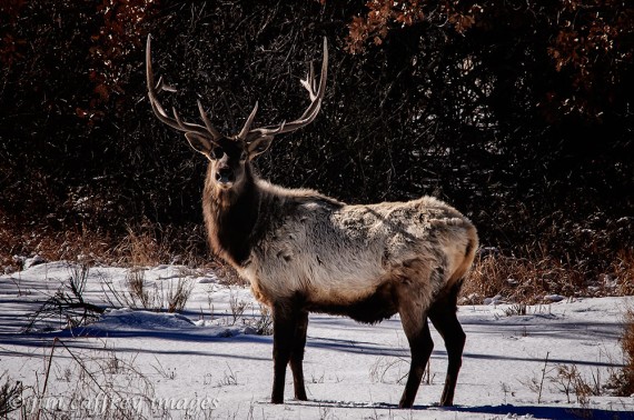
I knew from the time I made this photo of a bull elk in my yard on January 3rd that I was setting a high standard for the rest of the year. Also, not only was it serendipitous, but the image was a departure from my usual wide angle landscapes. I had been feeling for some time that my work had been stagnating, so I resolved then and there to take it in a new direction.
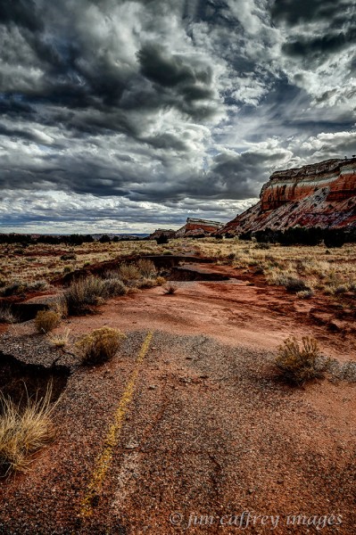
In early February, I ventured into an area along US 550 that I had been looking at as a shooting location for some time. I was drawn by some red sandstone pinnacles that were visible from the highway. As I walked toward them, I came across this old section of road that is slowly eroding, being reclaimed by natural forces. The scene made me realize how impermanent our impact on nature really is. In the end, this is the image that stood out above the others I made that day. Again: serendipity.
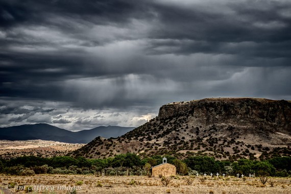
As the year progressed, I found myself revisiting some places I had been before. The image of the church on San Ildefonso Pueblo (a scene I had driven past countless times before) is more about the light than the subject matter. It is also a more visually compressed image than is usual for me due to my use of a longer focal length lens.
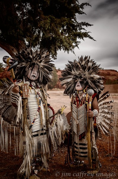
Every year at the end of May–Memorial Day Weekend to be exact–the Pueblo of Jemez hosts the Starfeather Pow Wow. Hundreds of native dancers from across the country come to dance and compete. I made hundreds of images that weekend, but this portrait of two brothers stood out. They are dressed in “dog soldier” head-dresses, hair-pipe breastplates, and feather bustles, all made by their father. Just before I released the shutter, I told them to give me some attitude. I think they did a pretty good job.
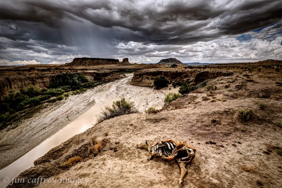
Anyone who is familiar with my work, knows that I spend a great deal of time in the Rio Puerco Valley. It was near the middle of July and the rains had just started after several months of searing heat and cloudless skies when I made this image. There are many possible causes for this animal’s demise, but the location of its desiccated remains along a now rain-filled wash and the rain falling from a heavy sky tells an ironic story about the uncertainty of life in this harsh environment.
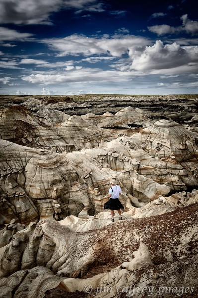
And speaking of harsh environments, the Bisti Wilderness in July can be a sobering place. The temperatures can soar to well over 100°F. I usually try to discourage clients from booking a photo tour during this time, but if the monsoons have started, it can be relatively pleasant and the cloudy skies lend a sense of drama to the scene. I made this image of one of my clients pondering the maze in the Brown Hoodoos section of the wilderness.
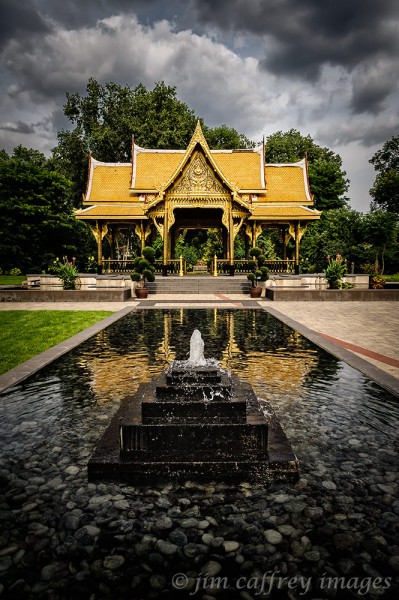
From a land of parched earth to a place where water is omni-present; my travels took me to Wisconsin in August. On a day-trip to Olbricht Botanical Gardens with my daughter, I made this image of the Thai Pagoda. Normally I steer clear of this kind of symmetry in a photograph, but the structure, and the entire environment seemed to demand it.
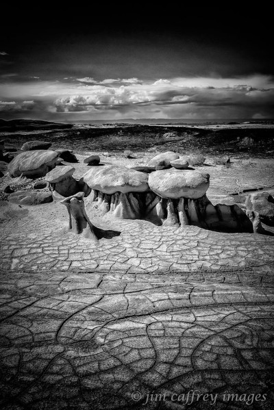
Autumn is the best time to be in the badlands, especially if the atmosphere cooperates. Even though the ground was soft and the washes were running from the rain, there were still cracks in the earth. It was as though the soil had a memory of the scorching it normally receives and refused to let go. After processing this image, I realized that it was best to convert it to black and white.
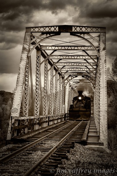
During the months of September and October I spent a great deal of time photographing the trains of the Cumbres-Toltec narrow-gauge railroad which runs from Chama, New Mexico to Antonito, Colorado. I spent every weekend for nearly a month chasing the trains and the fall colors. In the end, my favorite image had nothing to do with color and everything to do with the train, the track and the trestle.
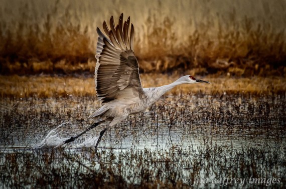
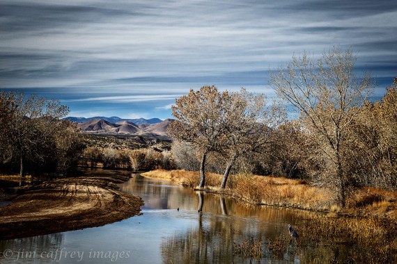
To most people, in the US anyway, November means thanksgiving. For me it is my annual trip to Bosque del Apache National Wildlife Refuge. Over the years, I have come to relish my time with the cranes, herons, geese, and other waterfowl that call the Bosque home during the winter months. Even though I have thousands of images of the birds flying, taking wing, landing, wading, eating, and doing whatever else it is that they do, I still managed to make two of my favorites there in 2013.
This first is obvious and familiar: a crane in the process of taking off from one of the ponds to fly to the fields where he will spend the day foraging. The second is a departure from my normal Bosque images, but one that illustrates the reason that I keep returning year after year.
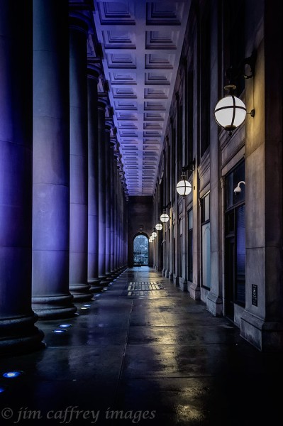
In December I travelled by train to visit my oldest daughter (an adventure I wrote about in my previous blog entry). Chicago’s Union Station was a surprise to me. I made several images inside the station and when I wandered out the doors to Canal Street, I found this scene. I was immediately drawn by the fact that while some of the elements had symmetry–there’s that word again–some didn’t. And of course the cherry-on-top: the wet pavement reflecting the lights and columns.
The (Other) Lybrook Badlands
I recently posted an entry about my efforts to find an out of the way section of the Lybrook Badlands. Wikipedia defines badlands as: a type of dry terrain where softer sedimentary rocks and clay-rich soils have been extensively eroded by wind and water. It can resemble malpais, a terrain of volcanic rock. Canyons, ravines, gullies, hoodoos, and other such geological forms are common in badlands. They are often difficult to navigate by foot. Badlands often have a spectacular color display that alternates from dark blue/black coal strata to bright clays to red scoria.
That’s a mouth full and if that definition is correct, then I think this image is about as close as I can get to capturing the essence of a badlands environment. What I’m trying to get at here is that this image was made outside of the area that is generally referred to as the Lybrook Badlands. It is, in fact right next to a major highway in northwestern New Mexico which sort of destroys any romantic idea of a wilderness miles from civilization. None of that really matters though; this area is as much a badlands as any remote, hard-to-reach, hard-to-find wilderness.
I made this image less than a mile from where I made the first one. You can make out the coal, scoria, and clay strata in the hills right next to the highway. I have driven past this place dozens of times on my way to somewhere else, and as is my way, I find myself wondering why I didn’t take the time to explore the area sooner. I had been drawn to it the first time saw it; a few years ago, I stopped by the side of the road and made this image, but went no further.
If it looks familiar it’s because I used it in a previous entry, but the point is: I knew this place had potential, yet it took me years to turn on to that dirt road.
Less than five hundred feet from the place where I stood when I made the roadside image, I came across this landscape. The small yucca nestled practically inside the shattered rock suggests that the cactus may have just emerged from the rock like a newborn bird from an egg.
The roads in this area don’t go very far; like most around Lybrook, they lead to gas wells such as the one shown in the above image, or well heads like the one shown below.
Natural gas development is what brings most of the people who live and work here, except for the Navajo people who have been around these parts for thousands of years, long before anyone knew what gas was, and, of course, crazy photographers who wander around hostile, but beautiful landscapes with a heavy pack full of cameras and lenses just because they’re there.
I’ll leave you with this photograph to ponder what kinds of natural forces sculpt a landscape such as this: these small round, flat stones seem to have been shed from the larger one, but why are they all shaped like that? I often find myself wondering about these kinds of mysteries when I am wandering around the badlands which are fast becoming a second home to me.
A New (Old) World
I have been exploring the area in and around the Rio Puerco Valley for years and I think I’ve driven just about every road out there. But, there is one that had escaped me until recently. I had driven past it many times, but had always assumed that it was a private road leading to a ranch that could be seen in the distance.
That’s what I get for making assumptions. I recently had reason to study a map of the area for a totally unrelated reason, and discovered that the road in question continued on well past the ranch in a long loop that returned to the main road via a BLM road that I am familiar with.
So, this past Sunday we set out to explore what is identified on the map as the Empedrado Wilderness (it’s actually a Wilderness Study Area which means it is being considered for wilderness status). Well, one of the first things I realized is that for a wilderness, there sure is a lot of human impact, both abandoned and ongoing. Of course the former captured my attention.
This stone ruin is perched on the edge of Torreon Wash and if the steep banks continue to deteriorate, it will soon be a pile of rubble lying in the wash. There is something about these recent ruins that touches me. I see the abandoned hopes and dreams of people who were probably toiling here in my lifetime and who may still come to these places to watch those dreams decay.
A little farther along we found this water system that, at first, looked as though it could still be in working order, but upon closer inspection it was found to be, dried up, broken and rusting away.
Just around the next bend in the road is an old school bus that is filled with what could be mistaken for building materials. Most of the insulation has become nests for the pack-rats, and other small animals that have laid claim to the bus.
After the first five miles or so, the evidence of human endeavor began to dwindle and the place began to look more like a wilderness. We drove on for another ten miles making note of areas of interest for future exploration. Then, after turning on to the BLM road that leads back to our starting point, I stopped to make this image of an ephemeral New Mexico rain falling over Cabezon Peak.
The Road And The Sky-Vol. II
When I was a much younger man, I spent a great deal of time standing by the side of a road with my thumb in the air spurred on by the likes of Jack Kerouac and Edward Abbey. Some of those roads were paved and four lanes wide; some were dirt or gravel and you couldn’t really tell how many lanes wide they were. I guess it really didn’t matter as long as they seemed endless.
 These days I’m somewhat tamer in my ways, but I still get a feeling of expectancy when I look through the windshield and see nothing but the road, the sky, and a wide open or unknown landscape. Until recently, however, I would not allow the hand of man to enter the world of my landscape photography, so the roads were banished.
 Now that I’ve overcome my phobia of including anything that smacks of man in an image, I am free to express my love of the open road in my photography. As I’ve mentioned in an earlier post, I am working on a project; I am making images of highways and byways as I travel around on my photo excursions. I hope to accumulate enough good photographs to publish a book. The images in this post are ones that have made the cut; some have been displayed in previous posts, but most of those have been re-worked to bring them up to snuff.
 My expectations of my own work have been becoming higher lately and because of that, I have been forced to either discard or re-process images that I was, at one time, happy with. Evolution.
 The only down side to all this road photography is that I seem to be spending a lot of time standing or kneeling in the middle of some very busy highways. Most of the time though, I’m on a road like Indian Rte. 13 or NM 16 which see very little traffic.
 And, at other times, I find myself on unpaved roads such as BLM 1103 in the Rio Puerco Valley, or small access roads like the one in the photo of the Shiprock Lava Dike below where I could stand for hours or even days without being in danger of becoming road kill.
 No matter if it’s a paved four lane or an unpaved ranch road, the idea is to get on down the road, maybe to a place where you’ve never been before, and that’s where the magic lies.
Versatile Blogger Award
I was just informed that I have been nominated for the Versatile Blogger Award. I am honored and I would like to thank Sherryl at Sat Nav and Cider for the nomination. I highly recommend her blog: great images and intriguing stories about an expat’s life in England.
Now to comply with the VBA’s rules, I must
- Thank the blogger who nominated me, and link to their blog (I’ve already done this above).
- Nominate fellow bloggers for the award
- Contact and inform your choices of their nomination
- Share 7 things about yourself
Here are my nominations:
- Antiquity and Adventures
- Bogdan D Photography
- Cornwall-A Photographic Journey
- Everyday Paranoid Visions
- In Search Of Style
- Islandmomma
- Joshi Daniel Photography
- Morgan Wiltshire Photography
- Random Sights and Diversions
- The Local Tourist-Colorado
OK. Here’s the hard part-7 things about me?!
- I am a father of two beautiful girls first and foremost.
- I have a wonderful partner who loves to come along on my photographic adventures (She’s a pretty darn good photographer in her own right!).
- I never leave home without a camera!
- I love teaching and sharing my knowledge with others.
- I never leave home without a camera!
- I have a cat.
- I never leave home without…well, you know.
So, once again, thanks to Sherryl, and of course to all of you who follow me, like and comment on my posts, and help to make up this wonderful community. See you down the road.
I couldn’t resist. 🙂
Shiprock-The Big Plug
New Mexico is a geologic wonderland. Much of the earth is laid bare by erosion, both wind and water sculpt the land removing the softer material and leaving the harder stuff to stand as enormous monuments to a time long past. Shiprock in the northwestern corner of the state is what remains of a volcano that erupted about twenty-seven million years ago. It now stands at a height of nearly sixteen hundred feet above the flatlands which surround it. The monolith is sacred to the Navajo people and it plays a large part in some of their creation stories.
I made this first image as we approached Shiprock from the west. I saw this as a great addition to my byways project; it also puts Shiprock in perspective in relation to its surroundings. The plain stretches for miles in all directions and the great volcanic plug is virtually the only-and certainly the biggest-thing to break the horizon.
As we got a little closer, there was a herd of ponies grazing peacefully with Shiprock in the background. Close by stood a trailer with a small addition. I assume these horses belong to whomever lives there. What a great backyard!
This last image was made after we drove through the breech in the largest lava dike. It is one of six that run for miles in all directions away from the central column. These dikes were underground lava tubes at the time of the eruption, they now stand high above the ground, like Shiprock itself, exposed by time and the elements
Take Your Camera
One of the first things I tell my beginning digital photography students is:“Always have a camera with you!”. I can’t begin to tell you how many times I have come across a wonderful scene and, without a camera, could only stand there and appreciate it. Not a bad thing, but as a photographer…!!!
I was driving into town for groceries-a sixty mile drive for me-and this scene unfolded along US Hwy. 550. I stood on the shoulder and waited until traffic cleared so I could make this image. Sometimes the light and the conditions combine to create a scene that may never happen again in exactly the same way. Be ready when that happens.
This image was made in a friend’s driveway. I was visiting him and noticed these leaves lying on the snow. I was drawn by the way they were nestled together and slightly embedded into the snow . I was taking my own advice that day and had a camera with me. The next time I visited him the leaves and the snow were gone.
This last image was made while I was driving from Albuquerque to Los Alamos to teach one of my classes. Just south of Santa Fe, these tracks cross under 1-25. I had gotten off the freeway and driven down the frontage road to the bridge over the tracks. I made several exposures of them from different points of view and was climbing up the bank to where my car was parked when I heard the whistle. The Southwest Chief (Amtrak), on it’s run from Chicago to Albuquerque was rounding the bend through the cut in La Bajada.
The point of these anecdotes is to illustrate the importance of being prepared. If you are in the right place at the right time armed with a camera a whole new world of possibilities opens up. To paraphrase Jack London: “You can’t wait for opportunity, you have to go after it with a club”.
Black and White!
Forty years ago when I purchased my first SLR camera-a Nikkormat FTN that I still have-I immersed myself in the world of black and white photography. Naturally, one of my heroes was, and still is, Ansel Adams. I learned how to develop film and make acceptable black and white prints from the negatives. I was hooked.
Fast forward to the present day: Photography has changed in ways no one could have imagined in that long gone time when a computer was still a large room-sized machine with unknown purpose and potential. Most of my work since switching from film to digital has been color landscapes. The portraits I have made are also (mostly) in color. Why? The answer is twofold: First, I lost that connection and, with it, the ability to visualize the scene and the image in the frame of my viewfinder in black and white. And, I just could not make a black and white print that matched those that slowly emerged from the developer under that red safelight. Granted, some of the shortcoming was due to my lack of expertise, but much of it had to do with the inability of the available technology to make an acceptable conversion
Recently, however, I have been re-connecting with that which I had lost in terms of visualizing my images in monochrome, and, with the ongoing development of new and better software, I find that I can once again produce a black and white or toned print that lives up to my expectations. Once again I can get excited about a black and white image the way I used to.
This image was made on a lonely highway in northern New Mexico. A storm was rapidly approaching from the south and the heavy clouds added to the feeling of desolation in the scene. The arrow-straight road with the mountains in the distance suggests a lack of any creature comforts. Even the rough texture of the road and the dark silhouette of the tree compound the sense of total isolation.
I did not pre-visualize this image as a black and white photograph. I like the way it looks in color, but I decided to experiment with it. I used Silver Efex Pro to do the conversion and I am very happy with the results. I think stripping the color adds even more to the bleakness of the scene. It lays bare the basic elements and structure of the image. Sometimes making a change in your pattern can help you to revitalize your passion and creativity. Even something as simple (or as complicated) as returning to your roots can breathe new life into your work.
This final image was made in the Mesa de Cuba badlands in the San Juan basin of northwestern New Mexico. It is a three image exposure fusion which I then converted to a sepia toned image in Silver Efex Pro. What caught my eye when I first happened upon this scene was the almost visceral appearance of the erosion channels. It had just snowed and the thirsty ground was sucking the moisture from the newly-fallen snow emphasizing the tonal contrast between the channels and the surrounding earth. At first I was concerned that it may be a little over the top in terms of the tonality, but I realized that I was merely presenting the scene as I had interpreted it. In the end, that’s what matters. Be true to your vision and you will evolve as an artist.
The Darkroom Geek
I recently read a comment thread on a well known social media site in which the person who originated the thread was trying to make the point that shooting in RAW format is not for everyone. Well, the lines were drawn and the battle ensued. Most of those involved seemed to be missing the point that the author was trying to make. One fellow went so far as to say that shooting jpeg was more demanding because you need to get your exposure right in camera. That’s true, but he seemed to skip over the part where a good deal of the image data is thrown away when the file is compressed, while a RAW file preserves all of the image data to be developed later in the digital darkroom. He then went on to say that–I’m paraphrasing here–shooting RAW is for geeks who would rather spend time in front of their computers than be out shooting images.
Well, I never considered myself a geek, but I do spend a fair amount of time post–processing my RAW files. And, I get a great deal of satisfaction from the act of finessing the image and taking it from its RAW state to a final polished image that can be printed on a wide format printer without loss of detail. There was another photographer, somewhat more well known than I am, by the name of Ansel Adams who spent a great deal of time in the darkroom–a darkroom geek I suppose. Adams was famous for his virtuosity with not only the camera, but for his manipulation of his images in the darkroom, where he would spend hours printing images that would go on to stir the souls of many.
Now, I’m certainly no Ansel Adams, but I do realize what he knew all those years ago. The process of making a remarkable, print-worthy image does not stop after the shutter is released. That’s where the photographer’s vision is captured surely, but bringing that vision to its fully realized state requires some post camera work in the darkroom whether it be a film, or digital capture. If spending time in front of my computer to make my images speak to the viewers in the way that I first visualized them makes me a geek, then so be it. I’m in good company.
The Road And The Sky
In keeping with my fascination with our connection to, and impact on the natural world, I have been making road images. There was a time not too long ago when I would go to great lengths to keep anything that smacked of the human hand out of my photographs. But, I have come to realize that it’s not really necessary to hide the things that we have “contributed” to the landscape. An open road in a remote location can create a powerful resonance in the human psyche, and so I hope that this realization can contribute to my ongoing, and (hopefully) never-ending growth as an artist.
This first image was made on US 64 west of Taos, NM, a few miles beyond the Taos Gorge Bridge. The atmospheric conditions were incredibly dramatic and that long stretch of empty highway was looking like the road to infinity. I love the possibilities that are implied by that vanishing point!.
Here is another photograph that suggests the same hope (or fear) as the first image. Sandoval County Road 279 runs south off NM 44 about eighteen miles north of San Ysidro. For nine miles or so it is paved. A short distance beyond the village of San Luis, it turns to dirt and continues past the ghost town of Cabezon and through the Rio Puerco Valley. This is a desolate part of the world, but in such places my spirit is renewed.
And finally here is an image of BLM Road 1103 which splits off County Road 279 close to Cabezon. From this point, it crosses the Rio Puerco and continues on past Cerro Santa Clara and Cerro Guadalupe, and then farther south along the eastern edge of the Rio Puerco. These roads whether paved or dirt give us access to the places that quench our thirst for wilderness, and for all those unknown destinations we have seen only in our dreams.
Road To Cabezon
Yesterday I set out with with no particular destination in mind. As I turned north on 550, I thought I might try to get a good shot of Cabezon from the highway. When I got to that stretch of road the sky was overcast, the light flat, so I pushed on, and turned on the road to San Luis and Cabezon.
As I got closer, and the great neck of lava grew larger, I decided to go all the way to the parking area. I was driving my car which has very little clearance, so I wasn’t sure I could make it. Sure enough, the road began to get rougher, so when I saw this two track leading off to the left I stopped. I had to play a waiting game with the sun which was obscured by the overcast. As it got lower in the sky, the light began to soften. I made some exposures, and this image is the best of the lot.
Equipment: Nikon D700, Nikon 17–35 mm 2.8 zoom lens, circular polarizer, Bogen tripod.
Camera Settings: f22, 1/15th sec., ISO 100
County Road 5872
County Road 5872
One day I took a drive out Highway 550. As I passed through Lybrook, I saw a road off to my right, and on impulse I turned onto it. The sign read CR 5872, and after about a half mile the road turned to dirt. It had rained earlier, and the road was pretty slick, so I decided not to venture very far.
At the bottom of a small hill, there was a drainage with a culvert and a fence line. There was also a wide spot in the road, so I took the opportunity to turn my car around, and to get out to stretch a bit. Something about the road intrigued me: the way it ran off to the horizon. I grabbed my camera and made three exposures. This is the pick. I made adjustments in Lightroom, but it still wasn’t quite right. If all else fails, do a conversion to black and white. This is the result.


